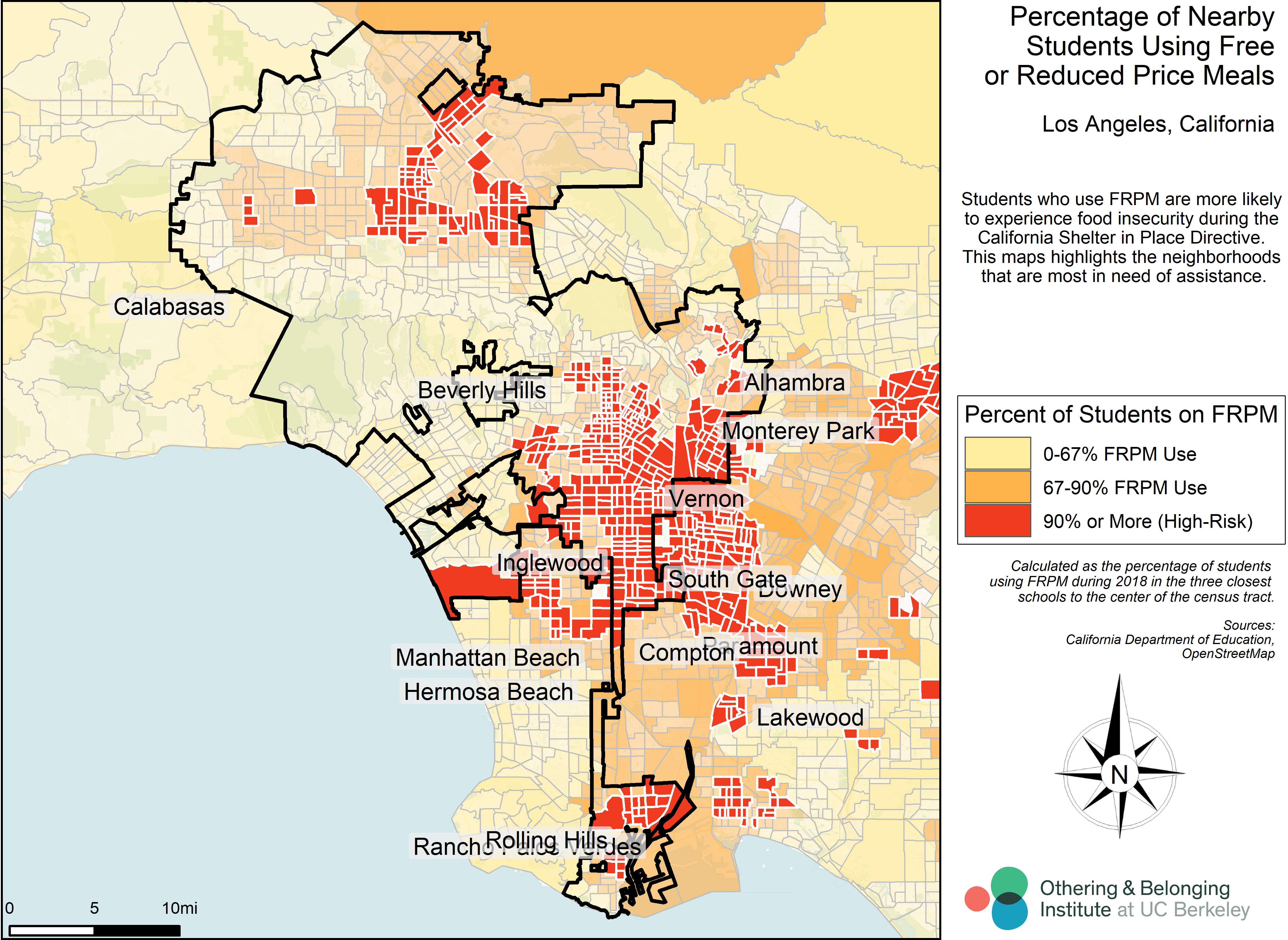
Kindergarten through Grade 12 students who benefit from free or reduced-price meals are more likely to experience food insecurity during the California Shelter in Place Directive. This set of maps highlights the neighborhoods that are most in need of assistance.
Click on a city name below to view its map. Cities are listed alphabetically.
- Anaheim
- Arcadia
- Bakersfield
- Bellflower
- Buena Park
- Burbank
- Carson
- Cerritos
- Clovis
- Compton
- Concord
- Downey
- El Monte
- Escondido
- Fontana
- Fresno
- Fullerton
- Garden Grove
- Hawthorne
- Industry
- Inglewood
- Jurupa Valley
- Lakewood
- Lancaster
- Long Beach
- Los Angeles
- Lynwood
- Modesto
- Monterey Park
- Moreno Valley
- National
- Norwalk
- Oakland
- Oxnard
- Palmdale
- Perris
- Pomona
- Rialto
- Richmond
- Riverside
- Sacramento
- Salinas
- San Bernardino
- San Diego
- Santa Ana
- Santa Fe Springs
- Santa Maria
- South Gate
- Stockton
- Tustin
- Victorville
- Visalia
- Vista
- West Covina


